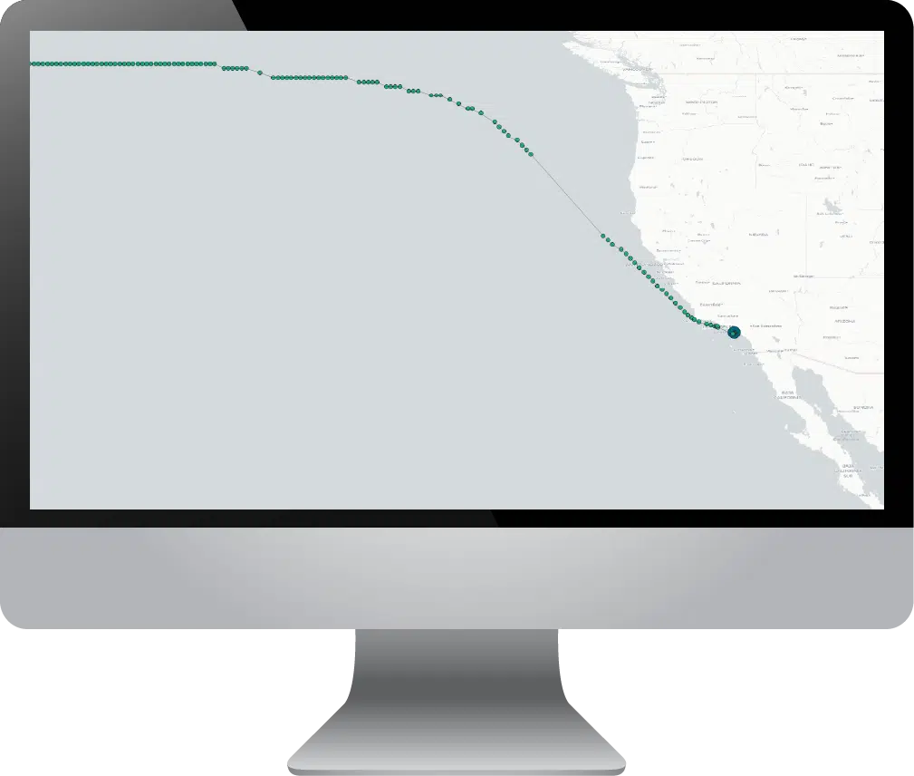
Visualize A Vessel’s Predicted Route Route empowers you with the ability to visualize the predicted route of a vessel using its IMO number or a known latitude/longitude.
Visualize a vessel’s predicted route on a map
Route enables you to visualize routes, whether it is a route between two ports, the next port call, or even a route that hasn’t taken place yet.
With Route, you can visualize a vessel’s predicted route, from its initial departure point to its designated target port. By simply inputting a vessel’s IMO number, Route harnesses its advanced algorithms to generate positions you can use for a map visualization of a vessel’s predicted route.
Why use Route?
Are you looking for an API that can provide you with accurate position data, so you can visualize the most direct, realistic, and likely vessel route on a map between two points?
With Route, you can:
Get an expected route from a known longitude/latitude to a target port
Get an expected route from a vessel’s current position based on its IMO or MMSI
Some of the benefits of using Route
DRAW EXPECTED ROUTE TO TARGET PORT
Route gives you the ability to visualize the expected route to your chosen target port.
RECEIVE LAST POSITION AND EXPECTED ROUTE BASED ON IMO OR MMSI
Route gives you the flexibility to either provide an IMO or MMSI and automatically receive the last position and expected route to your target port, or simply just a latitude/longitude.
Behind the scenes of Route
To provide the shortest and most realistic route, the predicted route algorithm takes historical AIS vessel movement patterns into account. Also, Route calculates position data based on vessel maps with multiple granularities and a default 15-meter draught.
Route is based on more than 40 input functions such as SOC, vessel type, course, historical data, speed, last port, etc.